Maps convey a certain perspective and it functions as a 2-D representation of the 3-D world. What does the cartographer want you to see? This project is a series of interviews on an interactive map. It is built on open source software and Google Earth. The idea of of the interactive map allows one to layer and juxtapose information to make connections with our knowledge of the world. It explores what people think the concept of maps and its functions means to them from artistic to functional – a map about maps. This interactive system can bring people together, virtually sharing their knowledge, thoughts and opinions. These layers are not static, they change as more people contribute their stories. The goal is for people to communicate through social software, learn, and explore in the virtual world using maps. In so doing, they can learn about each other’s cultures, geographies, and communities.
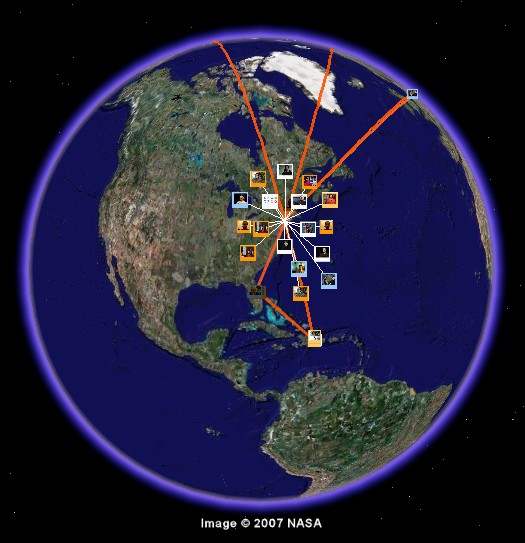
[above: screen recording of two projects (layers)
The first one: (polaroid icons in white feature opinions + thoughts about maps from artists, cartographers, geographers, students and etc.)
Second: (polaroid icons in orange and blue with orange lines) is a map used to feature students who are part of an organization called Harlem Children Society. This layer created is used to feature some of these students in under-resourced and under-served communities, their research, mentors, and parents stories. It shows diversity of neighborhoods and places where people are from so students can not only learn about each other’s research, but to explore and learn about each other and the world around them through the use of interactive maps. ]
More: Screenshot